
Filter by
SubjectRequired
LanguageRequired
The language used throughout the course, in both instruction and assessments.
Learning ProductRequired
LevelRequired
DurationRequired
SkillsRequired
SubtitlesRequired
EducatorRequired
Results for "geospatial information and technology"

L&T EduTech
Skills you'll gain: Geospatial Information and Technology, Spatial Analysis, Geographic Information Systems, Geospatial Mapping, GIS Software, Database Management, Database Management Systems, ArcGIS, Relational Databases, Decision Support Systems, Data Import/Export, Open Source Technology, Web Applications, Mobile Development

Skills you'll gain: Information Technology, Computer Hardware, Cloud Computing, Network Troubleshooting, Software Installation, Technical Support and Services, Cybersecurity, Cloud Infrastructure, Hardware Troubleshooting, Data Storage, General Networking, Operating Systems, Computer Security Awareness Training, Serverless Computing, Computer Programming, Databases
Skills you'll gain: ChatGPT, Generative AI, Artificial Intelligence, Data Ethics, OpenAI, Artificial Intelligence and Machine Learning (AI/ML), Deep Learning, Artificial Neural Networks, Application Deployment, IBM Cloud, Governance, Machine Learning, Business Transformation, Ethical Standards And Conduct, Computer Vision, Self Service Technologies, Information Architecture, Business Process Automation, Software Development Tools, Image Analysis
 Status: Free
The Hong Kong University of Science and Technology
Skills you'll gain: Systems Development Life Cycle, Information Assurance, Internal Controls, Information Systems Security, Compliance Auditing, Risk Management, Security Controls, Change Management, System Implementation, System Monitoring, Risk Analysis, Risk Mitigation, Software Development

Multiple educators
Skills you'll gain: Dashboard, Pseudocode, Jupyter, Algorithms, Data Mining, Pandas (Python Package), Data Visualization Software, Correlation Analysis, Web Scraping, NumPy, R Programming, Probability & Statistics, Predictive Modeling, Big Data, Automation, Computer Programming Tools, GitHub, Data Analysis Software, Machine Learning Algorithms, Unsupervised Learning
University of Toronto
Skills you'll gain: Geographic Information Systems, Geospatial Mapping, Data Mapping, Spatial Data Analysis, Data Visualization, Metadata Management, Quantitative Research, Typography, Data Cleansing, Data Validation, Design Elements And Principles, Data Integration
DeepLearning.AI
Skills you'll gain: Deep Learning, Artificial Neural Networks, Tensorflow, Supervised Learning, Keras (Neural Network Library), Artificial Intelligence, Machine Learning, Python Programming, NumPy, Performance Tuning
University of Toronto
Skills you'll gain: Spatial Analysis, Geographic Information Systems, Geospatial Mapping, ArcGIS, GIS Software, Data Manipulation, Data Synthesis, Data Visualization, Data Compilation, Data Processing, Data Mapping, Data Storytelling, Metadata Management, Data Integration, Data Management
 Status: Free
Stanford University
Skills you'll gain: Cooking, Preventative Care, Food and Beverage, Behavioral Health, Socioeconomics, Cultural Diversity, Education and Training, Culture, Environmental Issue

University of Toronto
Skills you'll gain: ArcGIS, GIS Software, Spatial Data Analysis, Spatial Analysis, Geographic Information Systems, Geospatial Mapping, Geospatial Information and Technology, Data Mapping, Data Visualization, Metadata Management, Query Languages, Data Manipulation, Data Synthesis, Quantitative Research, Data Compilation, Data Processing, Typography, Data Cleansing, Data Validation, Data Storytelling
University of Toronto
Skills you'll gain: ArcGIS, GIS Software, Spatial Data Analysis, Geographic Information Systems, Geospatial Information and Technology, Geospatial Mapping, Data Mapping, Data Collection

L&T EduTech
Skills you'll gain: Geospatial Mapping, Geospatial Information and Technology, Geographic Information Systems, Spatial Data Analysis, Construction Management, Visualization (Computer Graphics), Civil and Architectural Engineering, Spatial Analysis, Global Positioning Systems, As-Built Drawings, Survey Creation, AutoCAD Civil 3D, Environmental Monitoring, Systems Of Measurement, 3D Modeling, Data Cleansing
In summary, here are 10 of our most popular geospatial information and technology courses
- Geospatial Information Technology Essentials: L&T EduTech
- Information Technology (IT) Fundamentals for Everyone: IBM
- AI Foundations for Everyone: IBM
- Information Systems Auditing, Controls and Assurance: The Hong Kong University of Science and Technology
- Data Science Foundations: IBM
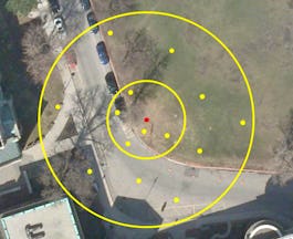
- GIS Data Acquisition and Map Design: University of Toronto
- Neural Networks and Deep Learning: DeepLearning.AI
- GIS, Mapping, and Spatial Analysis Capstone: University of Toronto
- Stanford Introduction to Food and Health: Stanford University
- GIS, Mapping, and Spatial Analysis: University of Toronto


