
Filter by
SubjectRequired
LanguageRequired
The language used throughout the course, in both instruction and assessments.
Learning ProductRequired
LevelRequired
DurationRequired
SkillsRequired
SubtitlesRequired
EducatorRequired
Explore the Cartography Course Catalog

Johns Hopkins University
Skills you'll gain: Rmarkdown, Tidyverse (R Package), Ggplot2, Spatial Data Analysis, Data Visualization Software, Statistical Visualization, Geospatial Information and Technology, Data Manipulation, Scatter Plots, Plotly, Interactive Data Visualization, R Programming, Data Wrangling, Correlation Analysis
University of California, Davis
Skills you'll gain: ArcGIS, Geographic Information Systems, Land Management, Geospatial Mapping, Spatial Analysis, Epidemiology, Emergency Response, Natural Resource Management, Business Development, Environmental Resource Management, Market Analysis, Risk Mitigation, Supply Chain
Coursera Project Network
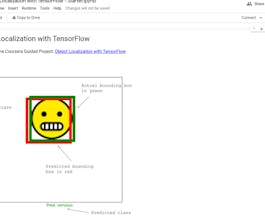
Skills you'll gain: Tensorflow, Keras (Neural Network Library), Test Data, Image Analysis, Computer Vision, Artificial Neural Networks, Deep Learning
 Status: Free
The Pennsylvania State University
Skills you'll gain: Geographic Information Systems, Systems Thinking, Design Thinking, Geospatial Information and Technology, Spatial Analysis, Community Development, Environment, Design, Environment and Resource Management, Decision Support Systems, Creativity, Cultural Responsiveness

California Institute of the Arts
Skills you'll gain: Graphic and Visual Design, Typography, Graphic Design, Visual Design, Design Elements And Principles, Creative Design, Digital Design, Creativity, Computer Graphic Techniques, Color Theory, Adobe Photoshop, Aesthetics

Skills you'll gain: SAS (Software), Forecasting, Spatial Data Analysis, Data Visualization Software, Time Series Analysis and Forecasting, Data-Driven Decision-Making, Predictive Analytics, Geospatial Mapping, Data Analysis, Geographic Information Systems, Data Manipulation, Statistical Programming

L&T EduTech
Skills you'll gain: Geospatial Information and Technology, Spatial Analysis, Geographic Information Systems, Geospatial Mapping, GIS Software, Database Management, Database Management Systems, ArcGIS, Relational Databases, Decision Support Systems, Data Import/Export, Open Source Technology, Web Applications, Mobile Development

Skills you'll gain: Data Storytelling, Data Presentation, Dashboard, Interactive Data Visualization, Data Visualization, Infographics, Data Visualization Software, Business Reporting, Data Ethics, Report Writing, Data-Driven Decision-Making, Generative AI, Web Content Accessibility Guidelines, Artificial Intelligence, Business Ethics, Automation, Natural Language Processing
Coursera Project Network
Skills you'll gain: Keras (Neural Network Library), Deep Learning, Image Analysis, Tensorflow, Computer Vision, Applied Machine Learning, Artificial Neural Networks, Predictive Modeling, Data Processing

Coursera Project Network
Skills you'll gain: Matplotlib, Histogram, Plot (Graphics), Seaborn, Scatter Plots, Data Visualization Software, Statistical Visualization, Graphing

L&T EduTech
Skills you'll gain: Geospatial Mapping, Geospatial Information and Technology, Geographic Information Systems, Spatial Data Analysis, Construction Management, Visualization (Computer Graphics), Civil and Architectural Engineering, Spatial Analysis, Global Positioning Systems, As-Built Drawings, Survey Creation, AutoCAD Civil 3D, Environmental Monitoring, Systems Of Measurement, 3D Modeling, Data Cleansing

University of Colorado Boulder
Skills you'll gain: Typography, Graphic and Visual Design, Design, Graphic Design, Digital Design, Design Software, Design Elements And Principles
In summary, here are 10 of our most popular cartography courses
- Advanced Data Visualization with R: Johns Hopkins University
- GIS Applications Across Industries: University of California, Davis
- Object Localization with TensorFlow: Coursera Project Network
- Geodesign: Change Your World: The Pennsylvania State University
- Fundamentos del Diseño Gráfico: California Institute of the Arts
- Using Data for Geographic Mapping and Forecasting in SAS Visual Analytics: SAS
- Geospatial Information Technology Essentials: L&T EduTech
- Data Visualization and Reporting with Generative AI: Microsoft
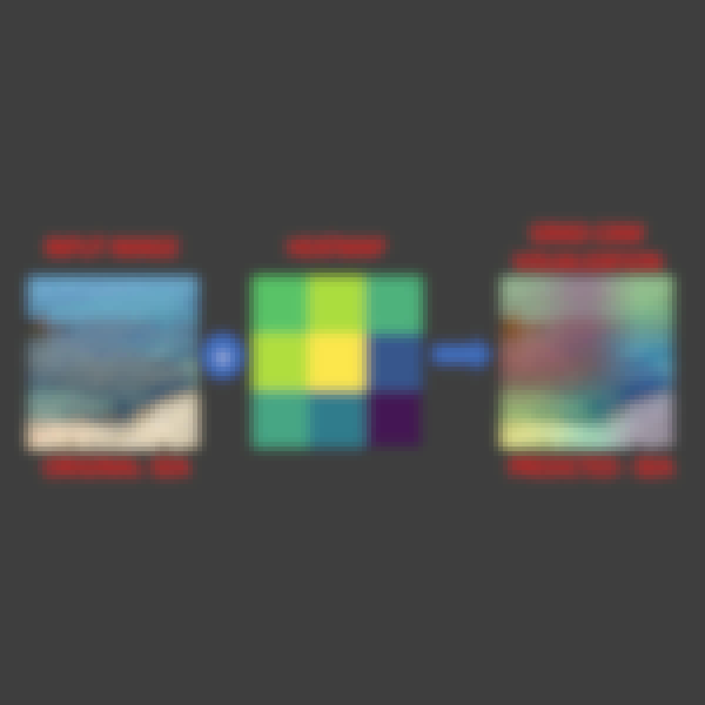
- Explainable AI: Scene Classification and GradCam Visualization : Coursera Project Network
- Python for Data Visualization: Matplotlib & Seaborn: Coursera Project Network


